In the fall of 2023, we conducted post-fire remotely piloted aerial system (RPAS) data collection at Old Man Lake in response to the devastating 2023 wildfire. This wildfire had a significant impact on the Wet'suwet'en Nation’s woodlot stock, affecting an area of 2,061 hectares. Working in collaboration with the Yinka Dene Economic Development Limited Partnership and the Ministry of Forests of British Columbia, our goal was to leverage remote sensing technology and geographic information system (GIS) desktop solutions to minimize costs associated with damage assessment, salvage harvest, remediation, and fieldwork planning.
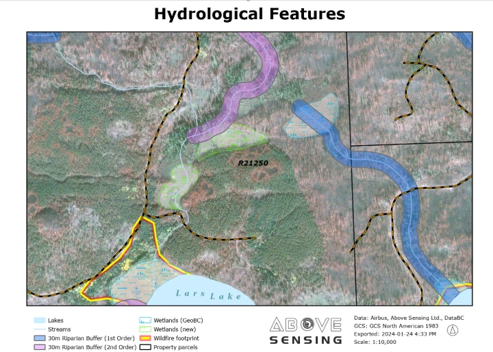
Our primary objective was to determine the most effective approach for post-wildfire surveying, exploring remote sensing technology applications and comparing them to a traditional survey methods. The project yielded several analytics products, including digital maps showcasing fire-related features, quantified fireguards, hydrological impacts, potential archaeological values, and salvage area maps.